Title
Map of Texas Showing Rock Island-Frisco Lones and Connections
Creator
Description
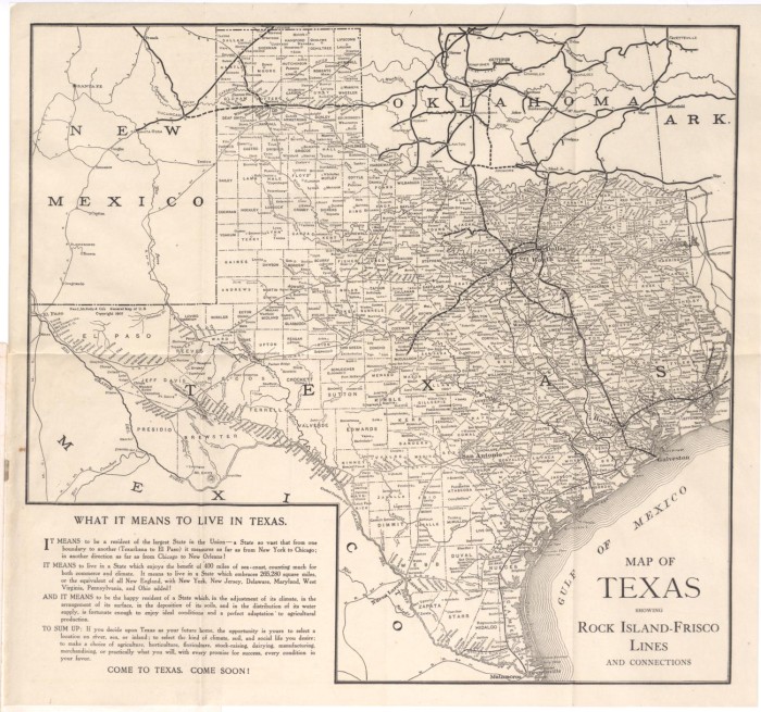
Map of Texas that is included in the booklet, Texas A Southwest Empire published by the Rock Island-Frisco Lines and Chicago & Eastern Illinois Railroad in 1909. It shows the Rock Island-Frisco railroad lines and connections in Texas, Oklahoma, Arkansas, Louisiana and New Mexico.
Subject
Date
Type
Map
Format
Language
Contributor
Access Rights
Image is displayed for education and personal research only. For individual rights information about an item, please check the “Description” field, or follow the link to the digital object on the content provider’s website for more information. Reuse of copyright protected images requires signed permission from the copyright holder. If you are the copyright holder of this item and its use online constitutes an infringement of your copyright, please contact us by email at rhizomes@umn.edu to discuss its removal from the portal.